Scotland local route-shape guide

Circular routes near Pitlochry

Compare 32 complete circular routes within 20 km of Pitlochry. Each route includes mapped distance, climbing, duration, surface context and its source record.

32 complete routes20 km fixed search radiusScotland location context

Compare the mapped facts

Choose by distance, climbing and route shape.

Featured ordering uses source completeness and waymarking—not invented popularity or ratings.

Across this collection, mapped distance runs from 1.7 to 65.0 km. The highest-climb record gains 545 m. The route snapshot was generated ; this page was updated .

Practical route questions

What to know before choosing.

Answers come from the route records shown on this page and keep the same safety limits.

How many mapped routes are available near Pitlochry?

Skreppa lists 32 complete, named route records near Pitlochry. Each result includes distance, mapped climbing, estimated time, activity, difficulty and a source link.

What distance range can I compare near Pitlochry?

The listed routes range from 1.7 km (Feldy Roo Fitness Trail) to 65.0 km (Dunkeld Dull Strathtay Loop). Use the full route page to compare climbing, duration, shape and surface information.

Are easy or circular routes available near Pitlochry?

18 routes are mapped as easy, and 32 routes are loops. Difficulty is source-derived guidance rather than a guarantee of suitability.

How should I check a route before setting out?

Open the route record, inspect its mapped geometry and source, then verify current access, closures, weather, daylight and local notices. Carry an appropriate offline navigation backup.

Mapped route records

32 routes near Pitlochry.

Check access, weather, closures and local notices before setting out.

#1 · Walkingeasy

Foresters' Trail

Near Faskally, Perth and Kinross

Foresters' Trail is a complete walking route mapped from OpenStreetMap. It covers 2.4 km as a loop route.

Distance
2.4 km
Climb
42 m
Time
0.6 hr
View route details
#2 · Hikingmoderate

Loch A Choire Route

Near Pitlochry, Perth and Kinross

Loch A Choire Route is a complete hiking route mapped from OpenStreetMap. It covers 11.6 km as a loop route.

Distance
11.6 km
Climb
435 m
Time
3.5 hr
View route details
#3 · Hikingmoderate

Atholl Woods Path

Near Birkenburn, Perth and Kinross

Atholl Woods Path is a complete hiking route mapped from OpenStreetMap. It covers 11.0 km as a loop route.

Distance
11.0 km
Climb
185 m
Time
2.9 hr
View route details
#4 · Walkingeasy

Banvie Burn Walk

Near Bailanloan, Perth and Kinross

Banvie Burn Walk is a complete walking route mapped from OpenStreetMap. It covers 4.3 km as a loop route.

Distance
4.3 km
Climb
88 m
Time
1.1 hr
View route details
#5 · Hikingeasy

Birks of Aberfeldy Walk

Near Aberfeldy, Perth and Kinross

Birks of Aberfeldy Walk is a complete hiking route mapped from OpenStreetMap. It covers 3.1 km as a loop route.

Distance
3.1 km
Climb
142 m
Time
1.0 hr
View route details
#6 · Hikingeasy

Birnam Riverside Path

Near Little Dunkeld, Perth and Kinross

Birnam Riverside Path is a complete hiking route mapped from OpenStreetMap. It covers 5.4 km as a loop route.

Distance
5.5 km
Climb
20 m
Time
1.3 hr
View route details
#7 · Hikingeasy

Braan Path

Near Inver, Perth and Kinross

Braan Path is a complete hiking route mapped from OpenStreetMap. It covers 7.0 km as a loop route.

Distance
7.0 km
Climb
125 m
Time
1.9 hr
View route details
#8 · Hikingeasy

Cally Loch and Hatton Circular

Near Upper Hatton, Perth and Kinross

Cally Loch and Hatton Circular is a complete hiking route mapped from OpenStreetMap. It covers 4.4 km as a loop route.

Distance
4.4 km
Climb
63 m
Time
1.2 hr
View route details
#9 · Hikingmoderate

Civil Engineering Walk

Near Balnacraig, Perth and Kinross

Civil Engineering Walk is a complete hiking route mapped from OpenStreetMap. It covers 11.0 km as a loop route.

Distance
11.0 km
Climb
216 m
Time
3.0 hr
View route details
#10 · Walkingeasy

Clachan Trail

Near Chapelton, Perth and Kinross

Clachan Trail is a complete walking route mapped from OpenStreetMap. It covers 2.9 km as a loop route.

Distance
2.9 km
Climb
84 m
Time
0.8 hr
View route details
#11 · Hikingmoderate

Clunie Path

Near Port na Craig, Perth and Kinross

Distance
10.5 km
Climb
359 m
Time
3.1 hr
View route details
#12 · Hikingmoderate

Craigower Viewpoint

Near Lettoch, Perth and Kinross

Distance
5.9 km
Climb
260 m
Time
1.8 hr
View route details
#13 · Hikingmoderate

Deuchary Hill from Dunkeld

Near Dunkeld, Perth and Kinross

Distance
17.2 km
Climb
477 m
Time
4.9 hr
View route details
#14 · Hikingmoderate

Duchess Cave and Cave Crag

Near Upper Hatton, Perth and Kinross

Distance
2.2 km
Climb
100 m
Time
0.7 hr
View route details
#15 · Hikingeasy

Dun Coillich Green

Near Glengoulandie, Perth and Kinross

Distance
7.9 km
Climb
333 m
Time
2.4 hr
View route details
#16 · Hikingmoderate

Dunkeld Christmas Grotto Walk

Near Dunkeld, Perth and Kinross

Distance
6.2 km
Climb
168 m
Time
1.8 hr
View route details
#17 · Cyclinghard

Dunkeld Dull Strathtay Loop

Near Dunkeld, Perth and Kinross

Distance
65.0 km
Climb
545 m
Time
4.2 hr
View route details
#18 · Cyclingmoderate

Dunkeld Loch Ordie Butterstone Loop

Near Dunkeld, Perth and Kinross

Distance
23.9 km
Climb
304 m
Time
1.7 hr
View route details
#19 · Walkingeasy

Farm and Forest Walk

Near Old Bridge of Tilt, Perth and Kinross

Distance
5.7 km
Climb
114 m
Time
1.4 hr
View route details
#20 · Walkingeasy

Feldy Roo Fitness Trail

Near Boltachan, Perth and Kinross

Distance
1.7 km
Climb
3 m
Time
0.4 hr
View route details
#21 · Hikingmoderate

Fiddler's Path

Near Inchmagrannachan, Perth and Kinross

Distance
10.2 km
Climb
73 m
Time
2.6 hr
View route details
#22 · Hikingmoderate

Hermitage, Rumbling Bridge and Inchewan Burn

Near Dunkeld, Perth and Kinross

Distance
11.5 km
Climb
188 m
Time
3.0 hr
View route details
#23 · Hikingeasy

Inchewan Path

Near Little Dunkeld, Perth and Kinross

Distance
8.6 km
Climb
183 m
Time
2.4 hr
View route details
#24 · Hikingmoderate

Inver Path

Near Inver, Perth and Kinross

Distance
8.0 km
Climb
101 m
Time
2.1 hr
View route details
#25 · Hikingeasy

Loch of the Lowes Path

Near Dunkeld, Perth and Kinross

Distance
7.5 km
Climb
136 m
Time
2.0 hr
View route details
#26 · Hikingeasy

Pine Cone Point Path

Near The Hermitage, Perth and Kinross

Distance
4.1 km
Climb
92 m
Time
1.1 hr
View route details
#27 · Hikingeasy

Ring Fort Trail

Near Chapelton, Perth and Kinross

Distance
3.9 km
Climb
104 m
Time
1.1 hr
View route details
#28 · Hikinghard

Rocking Stone Path

Near Inver, Perth and Kinross

Distance
5.0 km
Climb
220 m
Time
1.6 hr
View route details
#29 · Hikingeasy

The Duchess and the Bishop's Walk

Near Inver, Perth and Kinross

Distance
3.2 km
Climb
30 m
Time
0.8 hr
View route details
#30 · Walkingeasy

Torryvald Route

Near The Hermitage, Perth and Kinross

Distance
1.7 km
Climb
20 m
Time
0.4 hr
View route details
#31 · Hikingeasy

Weem Forest Trail

Near Castle Menzies, Perth and Kinross

Distance
1.8 km
Climb
80 m
Time
0.6 hr
View route details
#32 · Walkingeasy

Woodend Walk

Near Old Bridge of Tilt, Perth and Kinross

Distance
8.5 km
Climb
114 m
Time
2.0 hr
View route details

Your next step

Turn your Pitlochry shortlist into a trip.

Keep browsing routes and stops for free. Choose Premium when you need richer maps, terrain, weather and advanced planning where supported.

Explore for free

Check the map and compare your options before committing to a plan.

Open the free map

Go further with Premium

Compare included features and current prices. An account is needed to subscribe; browsing this guide is free.

Compare plans and prices

Your research: your Pitlochry shortlist

Choose how to plan your next outing.

Prefer a native map on your phone? See Skreppa’s iPhone and iPad app, illustrated here with a real route-planning screen. Check the App Store for current features, compatible devices and purchase options.

This guide remains available on the web. The Store link does not import this guide, transfer a route or start navigation.
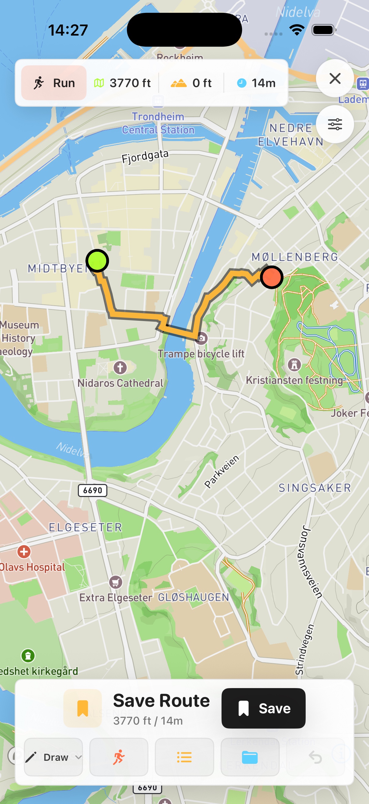
Real Skreppa iPhone route-planning screen showing an example route in Trondheim
Real app example in Trondheim—not the mapped location in this guide.